How to Read Mount Weather Forecasts Like a Pro

Planning a Mount Batur adventure and wondering if the sunrise will be a stunner or a foggy letdown? Weather in the mountains can be a bit unpredictable, but with a few simple tips, you can read the forecast like a pro and set yourself up for the best possible view.
Understanding Weather Map Basics
Checking the weather before your Mount Batur adventure? Knowing how to read a basic weather map can help you figure out whether you’ll get that golden sunrise or if it’s best to bring a rain jacket. It’s easier than it looks — here’s a quick guide to get you started.
- Cloud Cover: On most weather apps or maps, cloud cover is shown with little cloud icons or percentages. “Partly cloudy” (around 30–50% cloud cover) often gives you the best sunrises, with colours lighting up the clouds. “Overcast” means thick cloud cover — not ideal for views.
- Rain Probability: This is usually shown as a percentage. Anything under 30% is generally fine, but above 50% means it’s likely to rain. Keep in mind that mountain weather can shift fast, so always have a light rain jacket just in case.
- Humidity Levels: If humidity is over 90%, you might get foggy or misty conditions, especially in the early morning. Lower humidity means better visibility for those sweeping sunrise shots.
- Wind Speed & Direction: Light wind (under 15 km/h) is usually ideal. Too much wind can make the summit chilly — pack layers! The wind direction doesn’t matter too much unless you’re flying a drone.
- Temperature: Early mornings on Mount Batur can get chilly — sometimes down to 13–16°C (55–60°F). Dress in layers so you can stay warm during sunrise, then peel them off as the day warms up.
Now that you know the basics, check a reliable weather app or mountain forecast site the day before your tour. And if it still feels overwhelming, don’t worry — your local guide knows the conditions inside out and will help make the most of any forecast.
Specialized Mountain Forecast Tools
When planning a trip to Mount Batur, a regular weather app often won’t cut it. Mountain weather can change quickly and is often very different from nearby towns and cities. That’s where specialised mountain forecast tools come in — they’re built to give you more accurate info for higher elevations and rugged terrain.
- Mountain-Forecast.com – One of the most reliable for volcanoes and alpine spots. It gives you detailed forecasts by elevation, so you’ll know exactly what to expect at the summit, not just the base.
- Windy – Great for visual learners. You get live maps showing wind, rain, cloud cover, and temperature layers. It’s especially useful if you're concerned about visibility or planning to fly a drone.
- Meteoblue – Offers clear views of temperature patterns and cloud cover over multiple days. The “meteogram” feature is brilliant if you want to deep dive into mountain conditions hour by hour.
- AccuWeather Premium – While not mountain-specific, the premium version gives more detailed outlooks and tends to update more frequently than basic weather apps.
- Consult Your Local Guide – It might sound old school, but your guide knows the mountain best. They’ll often have up-to-the-minute insights based on years of experience watching the weather shift firsthand.
Using one or two of these tools before your tour gives you a better shot at knowing what’s coming — and helps you dress right, pack smart, and catch that once-in-a-lifetime sunrise.
Timing Your Mountain Adventures
When it comes to mountain adventures like a Mount Batur Jeep tour, timing really is everything. From catching that picture-perfect sunrise to avoiding the midday heat, knowing when to go can make your experience smoother, more comfortable, and a whole lot more memorable.
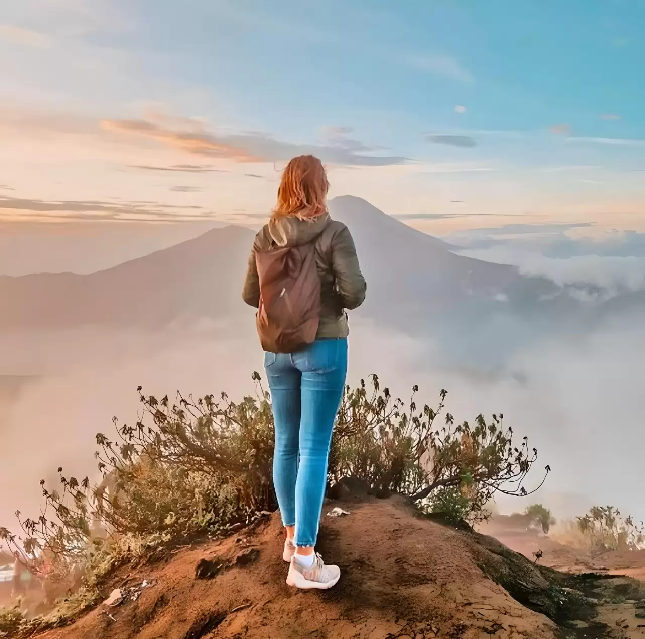
- Go for Sunrise (But Know What That Means) – Sunrise tours offer the most breathtaking views, but they start early — think 2am to 3am hotel pick-up. Worth it? Absolutely. The cooler air, golden light, and peaceful vibes make it unforgettable. Just be sure everyone’s prepped for an early start (yes, even the kids!).
- Avoid Late Morning Heat – After 9am, the sun starts to get strong, especially on the black lava fields where the heat reflects off the ground. If you're not doing sunrise, aim to finish your tour by mid-morning to keep things comfortable for all ages.
- Weekdays = Fewer Crowds – If your schedule allows, book your tour on a weekday. Weekends tend to draw more visitors, especially locals hiking the trail. Weekdays often mean quieter viewpoints and more space to explore.
- Dry Season = Best Views – The best time to visit Mount Batur is during Bali’s dry season (April to October). You’ll get clearer skies, less rain, and higher chances of catching that perfect sunrise.
- Check the Moon Phase – Fun tip! A near-full moon before sunrise lights up the landscape beautifully and can make the early drive and volcanic terrain even more magical.
With the right timing, your Mount Batur adventure becomes something truly special — whether you’re chasing the sunrise, exploring lava fields, or just soaking up the quiet of the mountains before the day begins.
Danger Signs in Mountain Weather Reports
Mountain weather can shift fast, and while most Mount Batur Jeep tours are perfectly safe, it’s still smart to know what warning signs to look out for in weather reports. Here are a few red flags that might mean it’s better to delay your trip or be extra cautious:
- Heavy Rain Forecast (Over 60%) – Rain doesn’t just mean getting wet. It can reduce visibility, make the volcanic terrain slippery, and even cause road closures. If heavy rain is in the forecast, it’s best to reschedule.
- Strong Winds (Over 30 km/h) – High winds can make the summit uncomfortably cold and potentially unsafe, especially if you’re planning to fly a drone or bringing small kids. Jeep rides may also be bumpier in exposed areas.
- Low Visibility or Fog Alerts – If visibility is under 2–3 km, you might not see much from the sunrise viewpoint. Check visibility reports or cloud cover percentages on apps like Windy or Mountain-Forecast.
- Thunderstorm Risk – Thunderstorms in mountain areas are no joke — they can roll in quickly, bring heavy downpours, and create dangerous conditions. If there’s any thunderstorm warning, it’s safest to stay off the mountain that day.
- “Overcast” + High Humidity – A forecast showing overcast skies paired with humidity above 90% often means thick fog and poor conditions for sunrise views. It might be worth rescheduling for a clearer day.
If you see any of these weather conditions pop up, don’t panic — just check in with your local guide. They usually have the latest info and can suggest the best option, whether that’s going ahead with a modified plan or choosing a better day to explore.